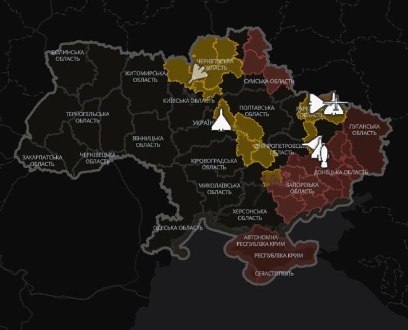
On October 17, 2026, Prime Minister Koretsky announced a new feature in the 'Air Alarm' app that allows users to track the approximate movements of enemy drones and missiles. This innovation is the result of a collaborative effort between the Ministry of Digital Transformation, the Ministry of Defense, the Air Forces of Ukraine, and Ukrainian IT companies.
Purpose of the Innovation
The primary purpose of implementing the map of enemy movements is to ensure quick access to verified military information during air attacks. In situations where every minute counts for the safety of civilians, it is crucial for people to receive timely data without wasting time searching for information in unverified sources.
Limitations of the Map
It is important to note that the map does not show the exact location of targets in real time. This means that users cannot rely on it for detailed information about specific targets. The Prime Minister emphasized that in the event of an alarm, it is necessary to immediately head to shelters and remain there until the all-clear is given. Additionally, ballistic movements will not be displayed on the map due to the complexity of tracking them.
Importance of Safety
The 'Air Alarm' app continues to play a vital role in ensuring the safety of Ukrainians during military actions. With the new feature, users gain the ability to be more informed about aerial threats, which can significantly reduce risks to the civilian population.